Showing posts with label Shenandoah national park. Show all posts

Tuesday, August 28, 2018

Come Hell or High Water ...it was High Water

James fished some fast high water

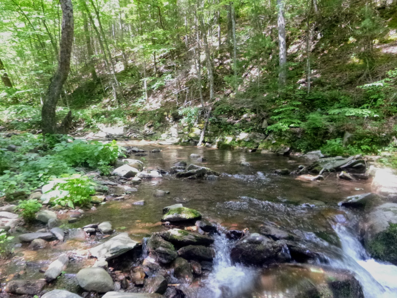
Boy we wanted to get out on the South Fork and were not going to be dissuaded by some high water....and high it was.   Optimal fishing here is below 1.75" on the Luray Gauge and we were actually happy to have it around 3" and stable.  Paul, Henry, James and I slid into the greenish stew of what looked like a new river Sunday morning.  Fishing was slow as we fought the surface current and tried to remember the hidden structure of our friend.


We coaxed some bass into action but our dreams of a 400 fish day melted away and we all adjusted our expectations and ended day 1 with maybe a hundred fish between the 4 of us. 


James had to head home to work and Paul, Hen and I feasted on beer, salsa verde, sausage and chicken as rain again began to splatter on the tin roof of our cabin.  The night ended w a great chat and Paul pouring rusty nails (scotch + Drambuie) for all.

Day two Team

Day two the began with the river dramatically rising as you can see on the graph below.


We experienced this rise real time and it was interesting to see it happen.  We couldn't really tell by rocks and shoals getting covered with water they were already well covered.  What noticed was a browning out of the water and alot of flotsam; sticks, a few logs in the main flow. 


Paul, Hen and I quickly made our way through the first mile of river and concentrated our attention where the river spread out under the large cliffs on the right.


Slow activity was the rule for the day and were thankfully interrupted by 3-4 fish here and there.  At about 1400 Paul got ahead of us and stayed ahead of Hen and I for the rest of the day and Hen and I enjoyed more and more success.  Hen lent me to a small popper which I fished on a 9'3" Orvis Graphite Spring Creek and had a blast.   Seeing smallies slash-up from the bottom and nail the popper was exhilarating.


Paul ended the day with some pontoon challenges in the final rapids and out of respect for his wife's nerves I'll leave that as a story untold. 

As the moon came up on our right and sun the sun fell below Massanutten Mtn the bass TURNED ON!   Henry was having success fishing the outflow shoulder of a rock eddy and called up to me.   I sat on my yak and floated down to him about 30' to his right about 50m above the beginning of the last rapid.  I stood on my yak and looked to join in Hen's success...OMG I caught bass on 14 straight casts and then caught 32 before I left the spot on probably 50 casts....amazing.  Hen caught a bunch as well but we theorized that perhaps I was presenting into a bass of bait fish the smallies were crashing.   By the time I was done Hen had moved downriver and was also pulling them out of slack water behind one of the bigger rock formations.   He fished till we couldn't see anymore as as he fought to the southern bank to get into his yak he disappeared in the dark!  We met about half way down the rapid and at that point were thankful for the high water to spirit us over the rocks.

Red Dirt Rich

Dinner night 2 was so good it may turn into a tradition the salad complimenting the seared cowboy ribeyes and washed down with beer...damn it was good.

Day three was challenging from the start and though we caught our share we planned to be off the river by 1530 so we didn't fish the dusk again.

When your on the river you are sharing the river

Thanks for Reading

Saturday, June 3, 2017

Scott's Run


A couple years ago Fritz, James and I were deep in the Big Run Watershed and had just started our walk out when we spied a sizable tributary flowing out of a hollow and joining the far side of Big Run .2 miles downstream from the intersection of Big Run Trail and Big Run Portal. I thought about gearing up but decided to study, see what stream it was and save it for an adventure for another day.   It turns out the trib was unnamed and there's only scant reference to it in a watershed study of the area.  Audaces fortuna invat so I decided to claim it and name it.     Here it is flowing into Big Run from the east/right of the map.


Here's what it looks like from the satellite view:


The hike down was 2.5 miles and took 71-minutes, with the mountain laurel in full bloom lining the path it was beautiful, but every step down reminded me of the hike out to come.


12 minutes into the hike at the 2nd switch back you cross the headwaters of Big Run.   2.2 miles into the the hike at the bottom of a descending ridge-finger finds the intersection of Big Run Trail (heads off to left) and Big Run Portal (follows Big Run down stream).


.3 Miles below the trail intersection located at 38.266146, -78.699944
Eppert Hollowing and the newly names Scott's Run pushes into Big Run.


Scott's Run to the left, the headwaters of Big Run to the right


To my excitement I caught this sweet little guy right under this sign.

This long pool was as far as I got up Scott's Run
I fished up Scott's Run for 200m, it holds lovely squaretails that I can't imaging see fishing pressure at all.    They were spunky and seemed happy to reward the effort, it was a thrill each time they rose to slap my fly.   Scott's Run, found, named and fished I walked 12-min downstream from the confluence and started fishing Big Run.   The air was a cool 58 and the water temp was the same. As the sun found its way deep into the run, bug life exploded.   Several pools I just watched as hatches emerged and trout rose to take them from the surface film.   An amazing morning.   I fished for three more hours and with plans to be corral smallies the next day, I began my walk out.  Enjoy these pics...


Big Run
Harry Murray's Mr. Rapidan took this fellow 


Foot rest for him

Foot rest for me

This 16 Parachute Sulphur was the most product fly today
If you're ready for an adventure get down to Scott's Run

Saturday, January 9, 2016

Brr ~ White Oak Canyon Run


Bryan flips to an icy pool on White Oak Run


Brr the water was cold, 41 as Bryan and I stalked up White Oak Canyon Run, the middle tine of a trident that when joined becomes the stocked and well known Robinson River. 41 is just too cold for even cold-loving trout to be spunky and the cloudy day kept the sun from warming the surface of this deep-canyon run. White Oak Canyon is an über popular hiking trail and we walked up the well established blue blazed trail for 10 minutes before the pools drew us to the icy river.  We had sporadic luck with small trout on both dries and more frequently droppers, but the water was just too cold for a consistent bite. The run was steely beautiful,  Finger numbing frigid water slid through chutes and licked icy flows and dams. We enjoyed the scenery and practiced our casting for about 4 hours and decided to call it a day and revisit this special place in the spring.   
Culvert marks the downstream extent of native trout on Cedar Run, twin-neighbor to White Oak Run
A well marked, blue blazed trail traces the right/eastern side of WOR 
Black and White captures the steely cold of the water
We caught 9 today, this one on an adams, but took few pictures as I thought, "Well, I'll wait for a bigger one."
Bryan (center left) blends in w the greys, blues and browns of the canyon run


WOR's gradient increases upstream 

A fallen tree and cold rock frame Bryan in a great pool