Showing posts with label brook trout. Show all posts

Monday, November 13, 2017

Big Hunting Creek

 The Catoctin Mountains opened in front of me and I couldn't suppress a deep smile as I jeeped north my stomach grumbling me onward to breakfast with Henry at the Kountry Kitchen in Thurmont.


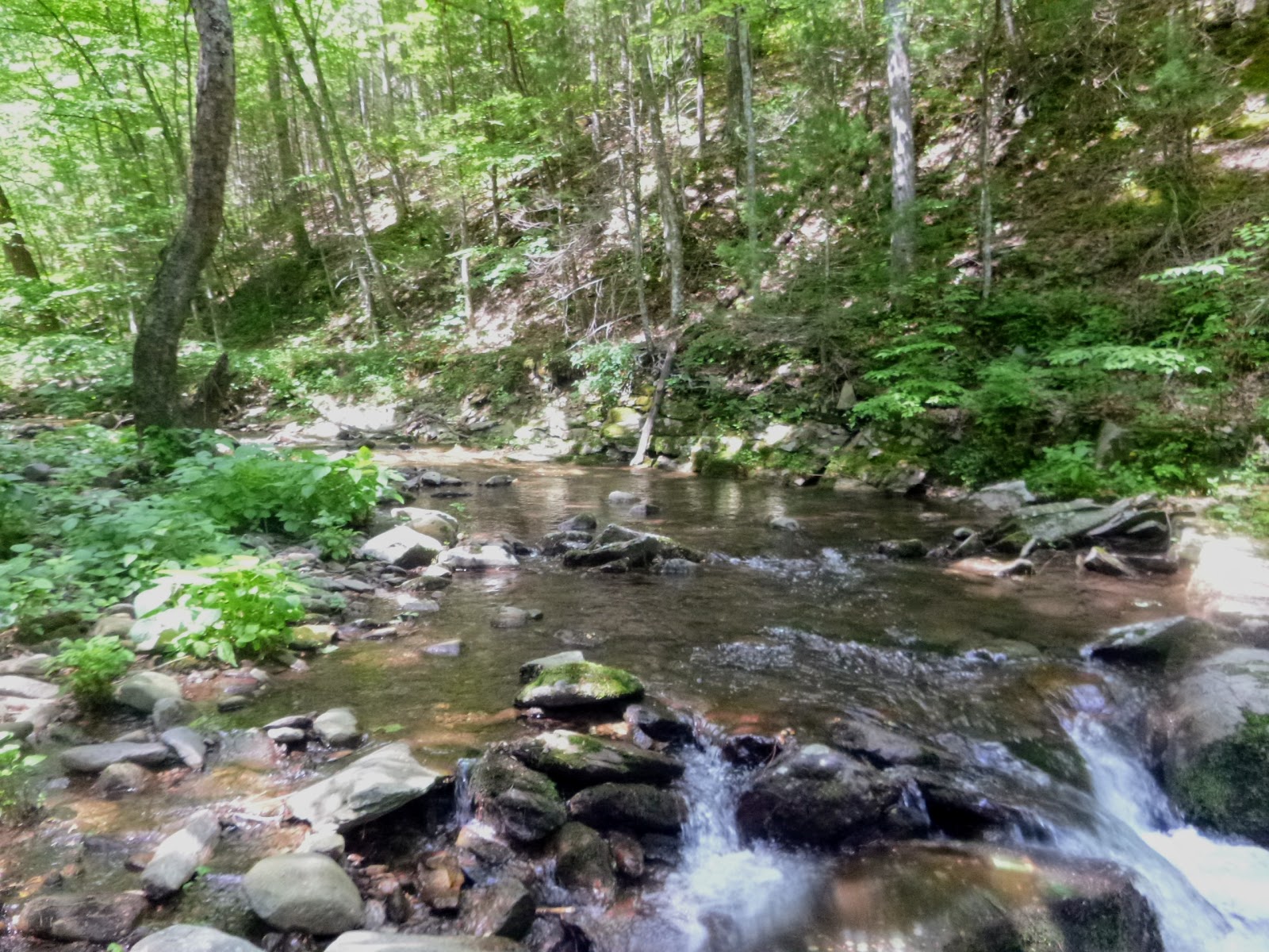
We've caught trout on several presidential waters; the Rapidan and Spruce Creek and wanted to add Big Hunting Creek to our list of POTUS escapes.    It'd been a balmy 47 when I left Virginia and it was 41 when I pulled into Thurmont, a taste of the finger numbing cold to come.  I wasn't finished my first cup of coffee when Henry jostled in for a great breakfast and review of our plans.   Big Hunting Creek is the major watershed in this section of the Catoctin Mtns and draws water from both sides of Hwy 77 as it flows both into and out of Hunting Creek Lake. Above the Lake is Cunningham Falls where our adventure began.


After working around some construction we found hwy side access to the section above Cunningham Falls and the fall beauty took our breath away...ok sliding down the water worn rocks of the falls
took our breath away too. 


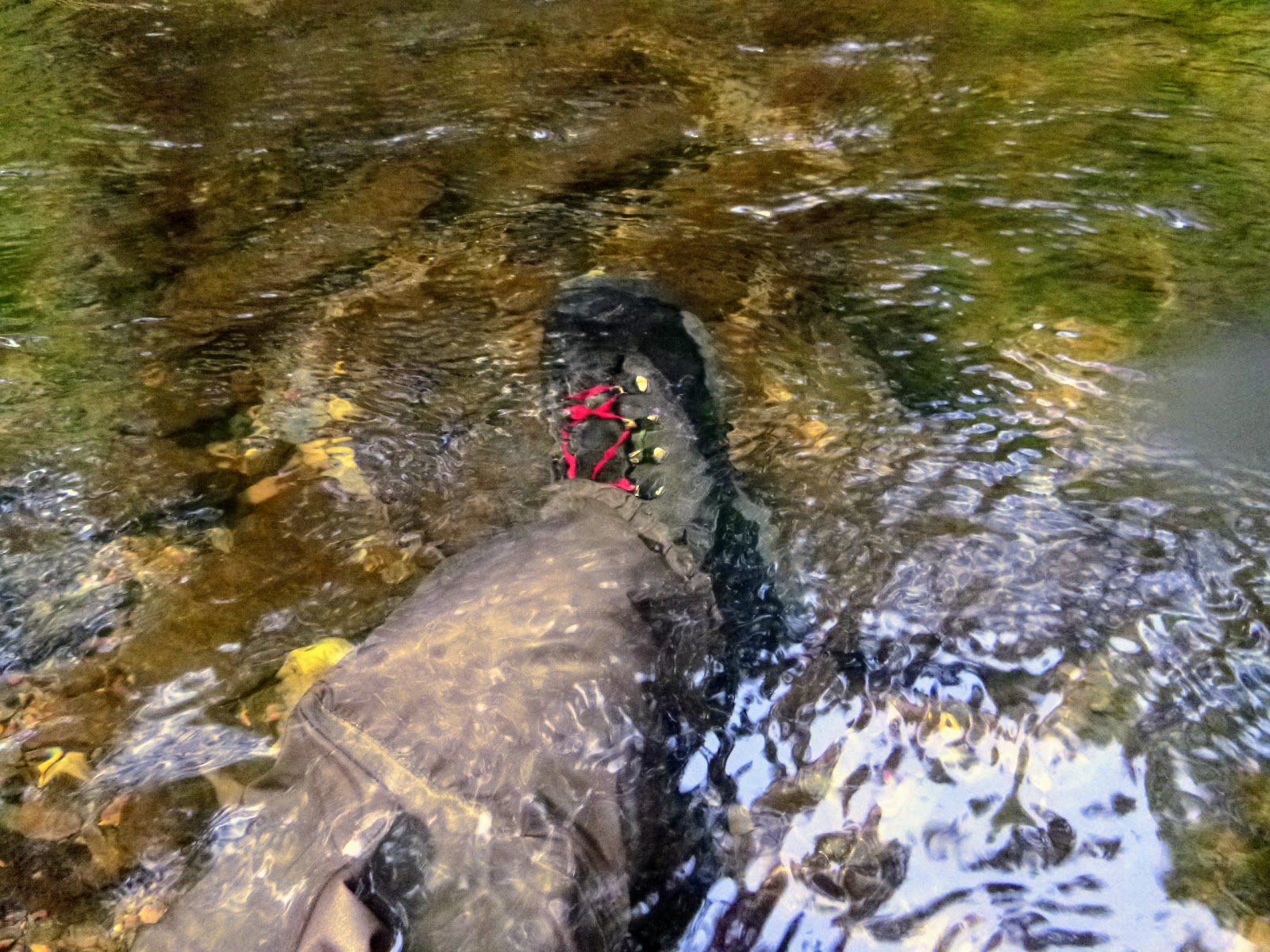
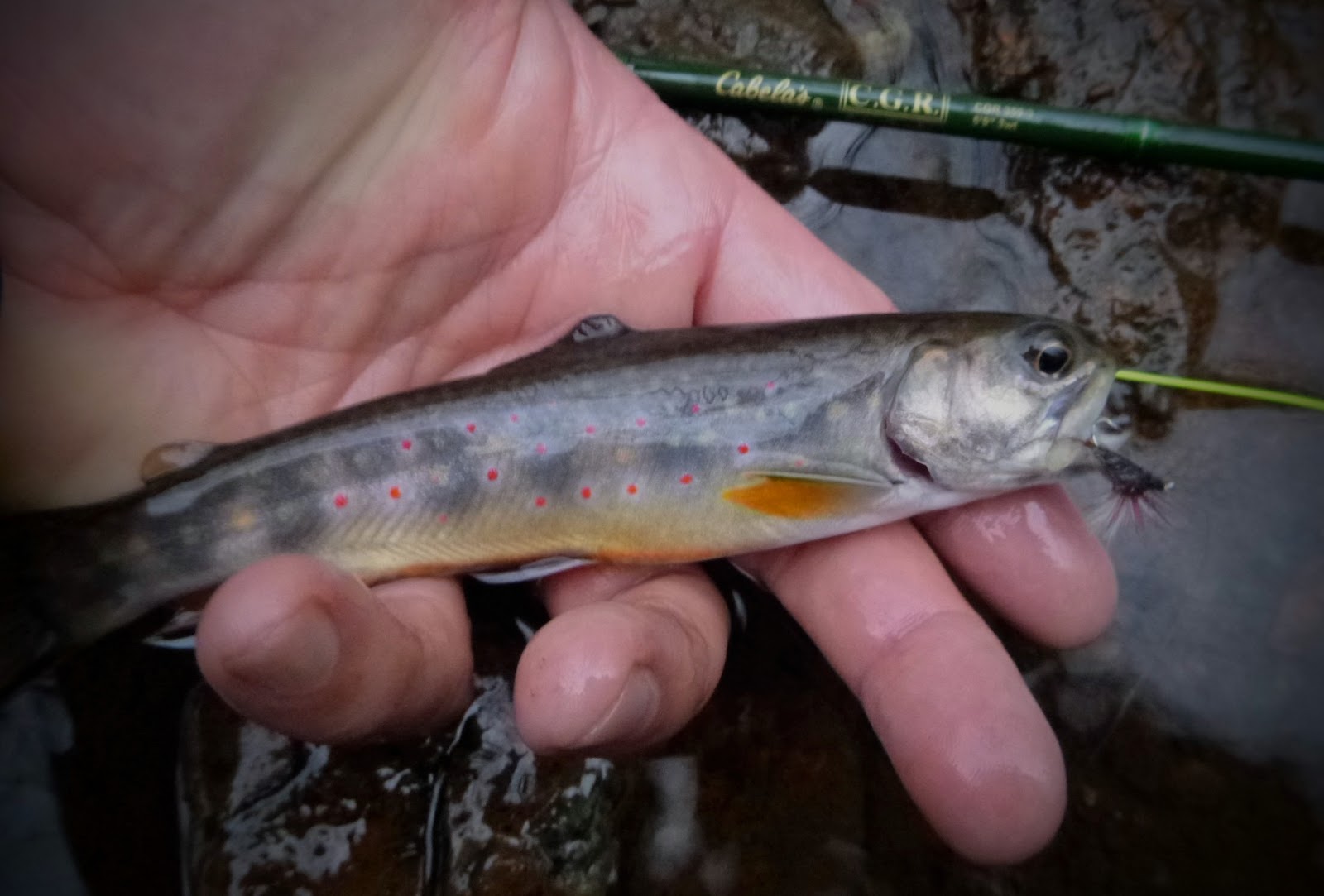
Armed with a 7' TFO BVK 3wt Henry got the first action of the day with a surface-roll to his top dropper in the plunge pool at the bottom of the cascade of falls but try as we might we couldn't get the trout to hook-up.  Trusting the metal crews in my boots (too much) I scampered up the smooth rocks and found a bathtub sized plunge pool 3/4 of the way to the top and dipped my dual dropper rig into a plate sized back eddy....WHAM, much to my surprise a 9-inch fall speckled brown nailed my offering.   I net netted him and hollered to Henry to check out my net when he scaled the cliff.  With a big smile on my face I sat among the Polar Cave-like boulders and didn't need to leave.


The Big Hunting Creek above Cunningham Falls quickly reaches the saddle in Catoctin ridge and loses the steep gradient which channelizes and gives it its character, we fished it for another 200m and walked back to our vehicles looking forward to checking out another portion before lunch.  We surveyed the feeder trip in the lower left hand corner of the map above and decided our better option was to fish the special regs tailwater section along Hwy 77. 


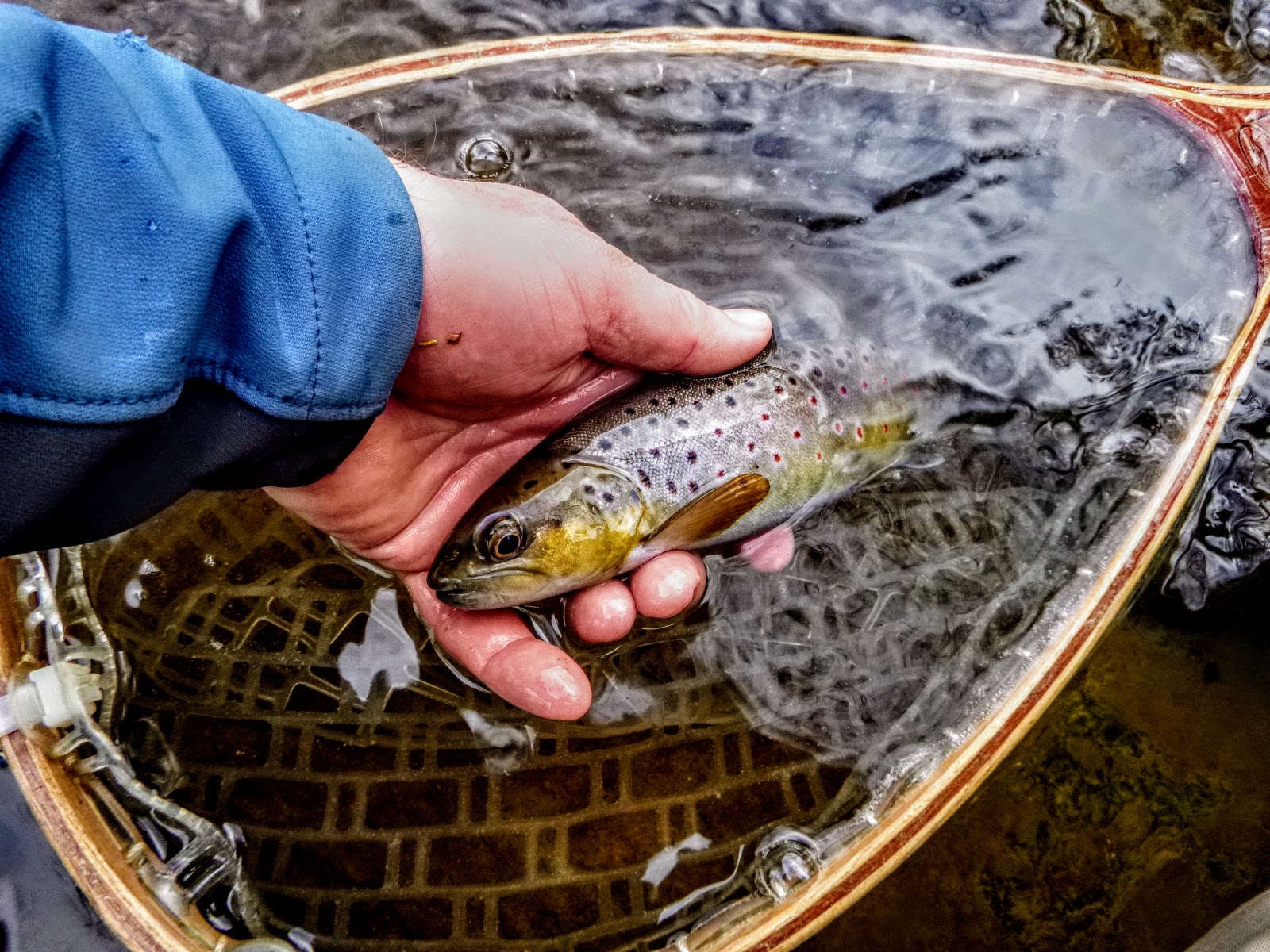
We noticed the nice flow and pocket water on our drive in and were soon questioning riffles and pools with dropper combos.   We both got a few stikes but Henry was the the only one able to land his quarry. 


With temperature dropping the the wind starting to whip up the river cut we decided to try our luck 15 Miles West at Beaver Creek.  After gas station sandwiches we found our way to Beaver Creek Fly Shop and must have met the owner on a bad day as he didn't seem appreciative of our support your local fly shop ethos and seemed put upon to offer advice...weird.    After I told him I wasn't interested in getting lectured about fall redds he broke out a map and gave us some advice (not sure if it was good or a false flag).

Beaver Creek is a classic spring-fed limestone creek.   I don't have alot of experience on them and in my view they are advanced degree fly fishing.   We tried a bit of everything (scuds, midges, nymphs, streamers) as we hunted likely flows, pools, undercuts, etc. w/o any hookups.    As the our line guides were freezing and the sun was dropping behind the trees to the West we finally found a lovely pool with good sized trout feeding subsurface and occasionally breaking the water.   Battling numb fingers, iced guides and the fading light we couldn't get these trout to come tight and left only when we weren't sure we could find out way back on the trail.


Saturday, June 3, 2017

Scott's Run


A couple years ago Fritz, James and I were deep in the Big Run Watershed and had just started our walk out when we spied a sizable tributary flowing out of a hollow and joining the far side of Big Run .2 miles downstream from the intersection of Big Run Trail and Big Run Portal. I thought about gearing up but decided to study, see what stream it was and save it for an adventure for another day.   It turns out the trib was unnamed and there's only scant reference to it in a watershed study of the area.  Audaces fortuna invat so I decided to claim it and name it.     Here it is flowing into Big Run from the east/right of the map.


Here's what it looks like from the satellite view:


The hike down was 2.5 miles and took 71-minutes, with the mountain laurel in full bloom lining the path it was beautiful, but every step down reminded me of the hike out to come.


12 minutes into the hike at the 2nd switch back you cross the headwaters of Big Run.   2.2 miles into the the hike at the bottom of a descending ridge-finger finds the intersection of Big Run Trail (heads off to left) and Big Run Portal (follows Big Run down stream).


.3 Miles below the trail intersection located at 38.266146, -78.699944
Eppert Hollowing and the newly names Scott's Run pushes into Big Run.


Scott's Run to the left, the headwaters of Big Run to the right


To my excitement I caught this sweet little guy right under this sign.

This long pool was as far as I got up Scott's Run
I fished up Scott's Run for 200m, it holds lovely squaretails that I can't imaging see fishing pressure at all.    They were spunky and seemed happy to reward the effort, it was a thrill each time they rose to slap my fly.   Scott's Run, found, named and fished I walked 12-min downstream from the confluence and started fishing Big Run.   The air was a cool 58 and the water temp was the same. As the sun found its way deep into the run, bug life exploded.   Several pools I just watched as hatches emerged and trout rose to take them from the surface film.   An amazing morning.   I fished for three more hours and with plans to be corral smallies the next day, I began my walk out.  Enjoy these pics...


Big Run
Harry Murray's Mr. Rapidan took this fellow 


Foot rest for him

Foot rest for me

This 16 Parachute Sulphur was the most product fly today
If you're ready for an adventure get down to Scott's Run

Saturday, January 9, 2016

Brr ~ White Oak Canyon Run


Bryan flips to an icy pool on White Oak Run


Brr the water was cold, 41 as Bryan and I stalked up White Oak Canyon Run, the middle tine of a trident that when joined becomes the stocked and well known Robinson River. 41 is just too cold for even cold-loving trout to be spunky and the cloudy day kept the sun from warming the surface of this deep-canyon run. White Oak Canyon is an über popular hiking trail and we walked up the well established blue blazed trail for 10 minutes before the pools drew us to the icy river.  We had sporadic luck with small trout on both dries and more frequently droppers, but the water was just too cold for a consistent bite. The run was steely beautiful,  Finger numbing frigid water slid through chutes and licked icy flows and dams. We enjoyed the scenery and practiced our casting for about 4 hours and decided to call it a day and revisit this special place in the spring.   
Culvert marks the downstream extent of native trout on Cedar Run, twin-neighbor to White Oak Run
A well marked, blue blazed trail traces the right/eastern side of WOR 
Black and White captures the steely cold of the water
We caught 9 today, this one on an adams, but took few pictures as I thought, "Well, I'll wait for a bigger one."
Bryan (center left) blends in w the greys, blues and browns of the canyon run


WOR's gradient increases upstream 

A fallen tree and cold rock frame Bryan in a great pool


Friday, December 18, 2015

Blue Line Recon -- Jordan River


Surprisingly Big Brookies for this tiny water
From the 211/522 intersection at Massies Corner West of Warrenton headed north, the first fishable water is the Jordan River.   I've long wanted to explore the Jordan as it's the closest blue line to our house.  The Jordan holds its secrets well, it's small water and is justly overshadowed by the lure of the Rapidan and Hughes to the south. 


It doesn't have publicized waterfalls to draw hikers,  it's not easily accessed from Skyline Drive nor is the trailhead obvious from the valley floor.  It took a deep-dive into hikers' BLOGs to find good directions to the Jordan River Trails' trailhead access tucked behind a private property gate at the end of Bean Hollow Road (RR 629) in the backwoods of the historic hamlet of Flint Hill.  


Jordan River from Lower Bean Hollow Road


Flint Hill is a historic community of 200 trying it's best to ignore the DC Sprawl, 50-miles to the east but a world away. From 522 north make a left on Fodder Stack Road, then a right on 659 then a left on 628.  When 628 takes a 90 degree left hand turn stay straight ahead on Bean Hollow Road (629) which weaves its way over the Jordan River.  


Part of the herd from the 'Over Jordan Farm'


'Over the Jordan Farm' is across the river to your right (North).  4 huge white herding dogs guard a large flock of sheep and greeted me with barks promising they would either lick me silly or rip me to shreds. 


cute log cottage on the way in tells you that you're almost these

This is a lovely dirt road, the kind of place you'd like to build a cabin and escape and when you get to the colorfully named 'Big Bastard Mtn Lane' you can see a cute tiny log cabin to your right where someone had the same thought when cabins were hewn from logs and insulated with clay. 
 
Proceed up this driveway from the end of Bean Hollow Road 
The other feature that caught my TU educated eye were the raised culverts allowing the Jordan to flow under the road, but barring trout from movement on the river.  A 1/4 mile after Big Bastard Mtn Lane Bean Hollow ends at a misshapen cul-de-sac. There's a powerline cut that comes down the Mtn from the right, the river crosses the road at 2-o'clock, the gated path (drive way) you'll walk up is directly ahead.    Circle around the cul-de-sac and park headed back in the other direction with your passenger door against the forest.    

Right of way is up the driveway and then on to your right


It way gray, raining and chilly when I pulled in and I gear-up in the back of the Jamie.  The gated drive (right of way) has a sign on it that says 320. I walked up the driveway access and in 75m there's a well cared for camp on the left with the trail and Jordan River a straight walk up on the right.   


Another 50m past the camp is the SNP access and trail marker with the first seemingly fishable pools on your right.  Once you get into the park on the raised trail with the river below and on your right, it feels like the start of the walk into the Hazel or the Upper Rose. 


Just past the cottage is the entrance to SNP -- start fishing here


I decided to walk up the trail to out walk any pressure and 13 min from the Jeep found myself at the top of a small hill with three runs crossing the trail from left to right.   This is small water and fearing that these runs might be the  headwaters of the river I followed them down 50m to the main stem.   


The hike up should you decide to walk up further

Jordan River trail is yellow-hash blazed

First Rainy pool yielded a spec on the first cast


Grabbing roots along the way, I slid down the thorny and moss covered bank into the small gorge carved by the river.   This is micro-water.  What the Hazel is to the Rapidan, the Jordan is to the Hazel.   The only water similar in size and constriction is Devil's Ditch off the Conway.    


An uncommon bigger pool for the upper Jordan

male Brookie, notice the colors and beginning of kyped jaw


With rain soaking my shoulders, the water beginning to stain, a #16 Adams-chute on my shortest rod, a 5'9" CGR Glass Road from Cabelas I was rewarded with a 6 inch brookie on my first cast into a small but inviting pool.


young male brookie


I ducked, twisted and belly rolled up stream and quickly found that the "river" disaggregated into non-channelized runs.   I had BTH 7 surprisingly nice brookies, but when Jacuzzi size pools turned into bath tubs and then into kitchen sink pools I climbed back to the trail and made my way down stream to see if there was fishable water below where I had turned off trail earlier. 


Small pools characterize the upper Jordan


another colorful male


With 45-min of fishing time left I slid down into the lower river just above the SNP entrance.   The water here is still small but much more accessible than the upper reaches where I felt like I was casting inside the hallway of a single wide.  


This pool is lower/ closer to the park entry, I caught one brookie here to the left of the little falls

 I caught another half dozen in my remaining time, caught a beautiful brookie on my last cast to total 15 BTH for the 2.5 hours fishing and then with a smile on my face and another blue line in my memories, I turned back to the jeep for dry clothes and a jolt of coffee.  The Jordan doesn't have miles of fishable water like some other more remote streams, but from the SNP marker up to the where it disaggregates there's enough water for one angler to spend a great day here.  


tangled but released unharmed


mature female brook trout -- Thanks