 |
| North Fork Moormans Brookie |
If I lived in Charlottesville the North Fork of Moormans River would be my home waters and I'd be very happy. The last time I'd been to this river was with Fritz a decade ago when it was still recovering from the massive deluge and flood that decimated the fishery for years. The water was so high it swept fish away and boulders scoured the banks pushing the protective, cooling foliage-shade from the banks of the river.
 |
| Marks the great flood 5 minutes into your walk upstrream |
Brook Trout here in Va can't survive the summer sun unless the is filtered by a riparian filter. There are still monuments to the flood here but the river and banks have largely recovered and with an active TU chapter and local catch and release crowd the river is only improving. There's no secret getting to the North Fork, take Barracks road west from Charlottesville through lovely hunt country and stay in it until it turns into Garth Rd. When Garth runs into the hamlet of White Oak stay straight on Sugar Hollow road and park at the end of the road beyond the reservoir which you'll see on your left.
 |
| pretty sure you know what this is |
When I arrived at the parking area I was surprised to see a dozen other cars tucked into the cul de sac. Thank fully many of these cars turned out to be hikers. Moormans River below the reservoir is well stocked and managed by the Charloteesvulle chapter of TU. I think you have to get a donation-permit to fish it, but I'm not positive. Above the reservoir is well marked stocked water as well. Here, where the riverbed is wide, you can see make out the damage from the flood.
 |
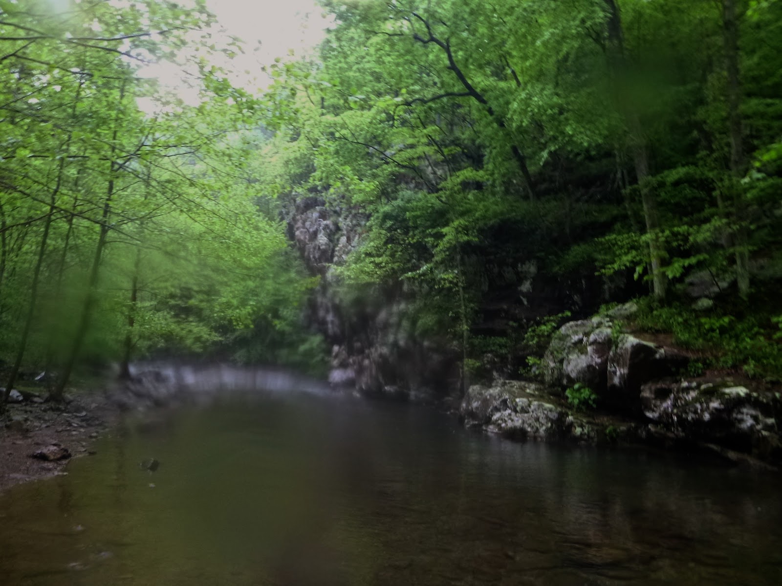
| Two views of Blue Hole Pool @ 1st Crossing -- rain blotting my camera |
From the parking take the trail immediately breaking an uphill sweat along the river. The South Fork of Moormans joins quickly, I knew it was there but couldn't see it as the path meanders away from the river up a bluff. I met another angler who suggested that I begin fishing after the second stream crossing and that above the second crossing (effectively the SNP Boundary) was the transition from stocked to native trout water. The view from first stream crossing is the quintessential picture of the North Moormans, a deep sweeping pool at the base of a steep cliff on the right. This pool is known as Blue Hole by UVA students who come here to jump from the cliff into the cold water (so says Conor, a well known jumper in these parts).


As I made my way another 150m to the next crossing and pool the rumbles of thunder and spits of rain announced their presence. A young woman was sketching on a rock at the top of the next pool so I moved upstream of her perch and began casting to likely spots as the patter of rain pushed through the canopy.
 |
| Sketcher pool just after the rain |
Thankfully I brought three specs to hand before the sky opened up and the fishing shut down.
 |
| The deluge had me looking Noah |
I didn't get much further up the river before I was soaked and cold. The rain stopped and I was fried. I caught one more trout on will power and then turned back anxious for dry clothes and a nice dinner with Conor. Next time I come to the North Fork I'll start above the 2nd crossing and move upstream from there. From what I could tell the fishing will only get better as pressure lessens with distance. A great day today. Trout in the Pocosin, Entry Run, South River and the North Fork. I ended the day eating with Conor at the Divide a great little Mexican restaurant right by the Amtrak Station near grounds. Be careful with the danger sauce-- pure habanero!


No comments:
Post a Comment