Fishing Adventures in search of perfection and peace while stalking native brook trout and bronzeback bass in the Mid-Atlantic Appalacians.
Friday, May 13, 2016
Pocosin Hollow
Pocosin Trophy in these small waters
I usually leave Jennifer a note when I adventure so she can tell Fritz where to holler for me when I don't come home, but as I kissed Jenny goodbye I couldn't tell her where I planned to be because I didn't know. I did know and greatly looked forward to ending the day having dinner with Conor in Charlottesville. With Northern Virginia still in its perpetual rain cycle, something like 21 of the last 22 days, I was destination-torn between catching a ton of specs on my home waters of the Rapid Anne or exploring new water, new blue-lines, south of the Conway River. Cedar Creek and the Rappahanock were high and muddy as I passed them and that would usually cause me to opt for clearer, lower water high up in the mountains, but for some reason, I passed the turn to Criglersville and kept jeeping towards Madison, Va. My plan at that point was park at the lower cul-de-sac access for the Rapidan and fish from there toward the ford (below junction pool) or if the water was too high to fish high up on the Staunton River. At the last minute I bore left at Wolftown Mercantile and headed to toward the Conway watershed. I had never been on these roads before so armed with my Delorme and a SNP topo I decided to see if there was access to the lower Pocosin just below where 677 is blocked on the west side of the Conway. Opinions differ about access, but I found it fairly easily and parked roadside as seen on the map.
View looking up Pocosin from 667 just before it enters the Conway
Park where it says shoulder parking
The Pocosin is a major tributary to the Conway with the same orientation and feel as its twin Devils Ditch another 1.5 miles up the Conway. From the parking area along 667 a sign indicates that its .6 miles (all uphill ;-) to the SNP gate. Take the streamside trail for 3 minutes, you'll come to Hidden Valley Road, bear right on the road and about 14 minutes after leaving parking you'll see a gate, pass the gate and continue up the well-posted trail until you reach the SNP marker at about 17 minutes. Fish up from there.
Follow this trail
keep walking
keep walking
Start fishing here (or move up if you like)
As I slid into the Pocosin I thought it was skinny and then found that this section of the Pocosin is disaggregated into several runs and I caught my first spec on an UNT coming in from my left.
Branch was not broken until it broke on me sending me to a spill
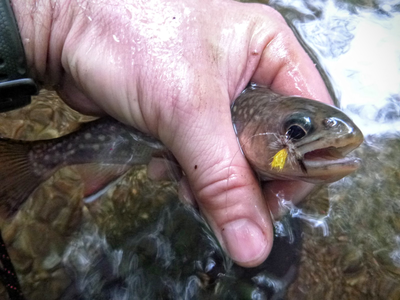
Caught first spec in this UNT of the Pocosin
UNT of Pocosin
As I fought uphill and to the main stem I found that the Poscosin actually fished bigger as you climb it. The terrain channelizes it into a central flow about 150m upstream from where I entered it.
Pocosin separates and joins at this point 100 up from SNP boundary -- fish upstream of this little island for bigger water
Aggregated Pocosin above island -- nice water
Light filtered into this hole beautifully
Here it's still narrow and tight, but there's plenty of water and pools to hold brookies all year. Really nice water and a fisherman would do well to spend a day sneaking up its rock chocked path. The brookies here don't see much attention and my Mr. Rapidan was like a steak to a starving dog.
flapping tail captured (not) by the camera setting
I caught brookies for an hour and then headed back to Jamie to unlock the mysteries of the next stream on my hit list, Entry Run.
Thanks for the great post! I just tried to fish the Pocosin from skyline drive, though it's a very long hike down to the River, in very rough country. I think I'll try from the bottom next time.
Also, what brand map are you using? It looks very helpful. Can it be bought online? Thanks!
I would strongly encourage readers to not take the route described in this blog post. The owners of the last house on this trail (located to the immediate left of the second photo above, of the closed gate with the "keep walking" caption) do NOT like people using this private road to walk the final bit of distance to get to the Pocosin Hollow Trail and they will yell at you if they see you. That last stretch really is a private road and, even if there is some sort of easement, the owners of the house don't seem to be aware of it.
Instead I suggest accessing from the top (skyline drive between mile marker 50 and 60--it's a bit of a hike down though). You can also access from the entry run trail at the end of 643:


Thanks for the great post! I just tried to fish the Pocosin from skyline drive, though it's a very long hike down to the River, in very rough country. I think I'll try from the bottom next time.
ReplyDeleteAlso, what brand map are you using? It looks very helpful. Can it be bought online? Thanks!
I would strongly encourage readers to not take the route described in this blog post. The owners of the last house on this trail (located to the immediate left of the second photo above, of the closed gate with the "keep walking" caption) do NOT like people using this private road to walk the final bit of distance to get to the Pocosin Hollow Trail and they will yell at you if they see you. That last stretch really is a private road and, even if there is some sort of easement, the owners of the house don't seem to be aware of it.
ReplyDeleteInstead I suggest accessing from the top (skyline drive between mile marker 50 and 60--it's a bit of a hike down though). You can also access from the entry run trail at the end of 643:
https://www.nps.gov/shen/planyourvisit/alerts.htm